Our maps
Probable Futures believes that humanity’s understanding of our planet and its systems, and our ability to understand how we can influence those systems, represent perhaps the greatest human achievement. Some of this understanding requires deep expertise, but we have found that everyone can grasp and relate to the most important features of our climate and climate change when given the good tools and useful information.
This section outlines key aspects of our process and provides you with guidance on how the data and the maps on this platform should (and should not) be used.
While supercomputers are necessary to run giant simulations of the earth, a much simpler tool can convey those results meaningfully and usefully: maps. If you can read a map, you can learn most of what you need to know about climate change. We have worked to make our maps clear and easy to use. We have also tried to make them beautiful, because seeing the world in this way is a wonder. We find that feeling wonder as you explore even difficult probable futures is helpful.
All data on the interactive maps are sourced from the CORDEX-CORE framework, a standardization for regional climate model output. We currently use the REMO2015 and REGCM4 regional climate models. REMO2015 and REGCM4 are the only two RCMs that have been run on all domains in CORDEX-CORE, an effort which downscales data from multiple GCMs in the CMIP5 ensemble of global climate models. We will continue to consider additional models for inclusion as they become available.
We chose these measures of climate phenomena for their potential relevance to people and the systems we rely on, both at global and regional scales. For example, we include several different datasets for each measure of climate phenomena (e.g., Days over 32, 35, and 38°C). We do this so that you can explore thresholds that are important to your region, industry, or interests. For example, a particular temperature threshold may matter more in eastern China than in southern Australia. Similarly, a particular measure might have meaning for a utility manager, but not for a coffee farmer in the same region.
The physical impacts of climate change, such as extreme heat, drought, and precipitation, are directly linked to global average temperature, not dates or timelines. In other words, the dates that the earth may reach certain warming scenarios are not predetermined but depend on our emissions.
You may see other maps that project specific dates. The people who created the data for those maps had to forecast emissions scenarios—a specific, complex combination of human activities. Our approach has fewer assumptions. In addition, we believe that people may interpret maps based on dates as predictions that are final, which we can’t do anything about. On the other hand, using warming scenarios communicates that the scale and timing of climate change is within our control. In addition, using different models at the same warming level removes sources of bias that occur, forcing models to line up in time instead of in atmospheric conditions.
Whether you are looking at climate projections on a publicly available map or one commissioned from a climate data service provider, it is important to understand who is producing the data, what models they are using, and what methodological choices they are making. These factors will vary depending on the intended use and the skill sets of those analyzing and presenting the data.
In general, temperature data will be the most consistent of all climate phenomena across models because heat is fundamental. Every part of our climate is caused or influenced by it. As such, scientists design climate models with temperature at their core. That is why the Probable Futures platform begins with heat and presents maps of many different temperature phenomena.
Our colleagues at Woodwell analyze climate model output that simulate possible outcomes. These simulations produce temperature, relative humidity, rainfall, winds, atmospheric pressure, and other aspects of local weather. For every simulated day in every grid cell we can look at high and low temperatures, quantity of precipitation, etc. The richness of the data allows us both to investigate what conditions would be like under different climate scenarios and to check to see how “good” the models are. Scientists refer to the ability of the models to produce realistic results as “model skill.”
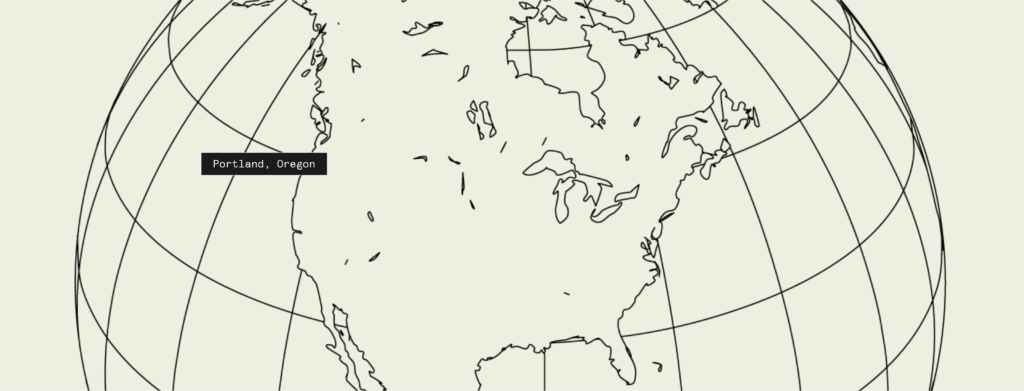
Many researchers have worked with these models in recent years, so there are academic studies of model skill, but we wanted to see if the models “felt right” to us. Since the Probable Futures team is spread out, and became even more so during the pandemic, we looked at places we knew well. Early in 2021, a key member of our team named Isabelle decided to move to Portland, Oregon, a city in the Northwest of the USA. She had never even visited there. No one else on the team knew it well, but we all thought of it as pretty mild. Together we looked at the model results for the grid cell that included Portland. The below slide show provides a good case study in the model results and in the way to apply them.


The data and educational content we publish on our maps go through a rigorous review and validation process.
We have a thorough internal quality control process that includes review cycles within Woodwell and consultation with other leading climate scientists. The internal review takes place early in the data development process, after making and testing initial methodology choices. The external review takes place when the data are in final draft form.
Note that we don’t intend for the review process to exactly replicate an academic publication peer review. We ask external reviewers to assess the dataset from a holistic perspective, confirming that chosen methodologies are used in the scientific community, that assumptions made are defensible, and that documentation is sufficient for replication. We also ask reviewers to pose questions and make recommendations more broadly about the methodologies and associated documentation. We are grateful to many scientists who have volunteered their time and expertise. Probable Futures will continue to evolve and update.
- Treat the data as a tool. It is important that anyone using Probable Futures maps understands that while the maps offer specific values, the results represent a range of possible outcomes within a computer program that models the earth. In other words, you should not take results as a specific prediction, but rather as a tool that can give a sense of the scale and likelihood of certain climate outcomes and how that scale and likelihood change as the atmosphere changes.
- Investigate how the models were made. We encourage anyone producing or applying climate data to both make efforts to understand what models and approaches to downscaling are being used, as well as assumptions within those models, and to disclose those details to relevant audiences and stakeholders.
- Disclose how you are using the data. Climate disclosure frameworks such as CDP or the Task Force on Climate-related Financial Disclosures (TCFD) can be helpful guides and are rapidly advancing to provide standards for physical climate risk disclosure. We encourage such standards and are hopeful that Probable Futures can be a helpful resource. Woodwell and Wellington Management have also recently published frameworks for disclosure as a complement to these sources.
- Shared information makes us stronger. The open scientific community has thousands of dedicated, skilled practitioners collaborating and sharing their results. We believe that communities from the local to global can better address climate change with shared information than if only a small number of people have “their own” climate information.
Heat, precipitation, and drought are the primary phenomena we portray on our platform. Why these three? Probable Futures aims to serve as a resource for well-established, well-understood, and well-vetted climate science. The specific climate phenomena we choose to include on our platform must meet rigorous scientific standards and be available at a near-global scale. Heat, drought, and precipitation are all first-order, fundamental climate phenomena that have physics that are well understood, and that can be modeled on a global scale relatively accurately. In addition, they are relevant everywhere.
Furthermore, human activity plays a significant role in the occurrence of some second-order climate phenomena like wildfires and flooding. For example, humans often ignite wildfires and live in wildfire-prone areas called the wildland urban interface (WUI), and flooding infrastructure in a given location can determine whether that location floods—or not. These factors make modeling much more complex, and theoretical, especially on a global scale.