As climate change contributes to more frequent and higher-impact natural disasters, decision-makers around the world need to be prepared and equipped for fast response.
Kontur is a geospatial mapping organization that uses technology and data to inform disaster response and preparedness for business, government, and humanitarian organizations. Its publicly available tool Disaster Ninja layers climate data over humanitarian metrics such as population, fire service and shelter scarcity, and map completeness—helping humanitarian actors better prepare for and respond to disasters.
We initially developed Disaster Ninja to provide everyone with better maps, especially communities prone to natural hazards that are often underrepresented on the map. But climate data of granular resolution on a global scale is a kind of data that takes a lot of work to obtain, so we were excited to experiment with Probable Futures’s map data to provide new insights for Disaster Ninja users.

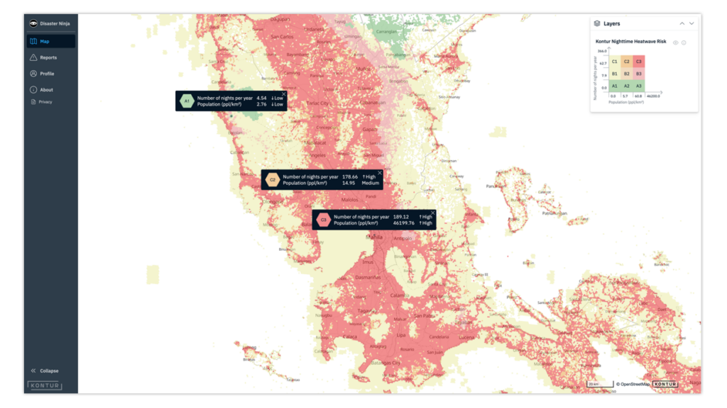
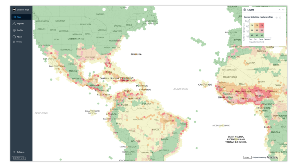
Kontur wanted to produce a map layer that would allow users to identify places facing an increasing risk of nighttime heatwaves, which are critical health hazards that can result in power outages, deaths from heat stress, and increased hospital admissions from heat stress. They needed highly accurate, scientifically rigorous climate data to layer over their own population location and density data set.
To build this layer, Kontur applied Probable Futures’s “Nights above 25°C (77°F)” map data to its own maps of densely populated urban areas. The result is a “Nighttime Heatwave Risk” layer, which allows humanitarian workers to identify communities facing heat risks and develop response plans.
The Nighttime Heatwave Risk layer helps people visualize vulnerable communities at risk of heat stress—important information for governments and first responders to allocate electrical or water resources to areas in greatest need.

Kontur hopes that putting this information out into the world for free will encourage better planning and more preparedness and eventually save lives.
By overlaying Kontur data with the Probable Futures’s map data, we have been able to add the humanitarian perspective to the impacts of climate change. This enables local communities to visualize the challenges ahead and, in turn, engage their governments to defend their right to the environment on the global stage of climate policy.